LithoPeaks
Mountain hikes & training, Lake District

A good starting point for this hike is Walna Scar Car Park (grid reference: SD 289 197) located southwest of Coniston village. This car park provides easy access to multiple peaks in the Coniston Fells range.
The Coniston Fells feature well-established trails leading to summits such as The Old Man of Coniston, Dow Crag, Brim Fell, and Swirl How. The paths range from moderate ascents to steeper, more technical sections where scrambling may be required. Exposure varies. With some ridge sections, like Dow Crag and Steele Ridge, featuring steep drops, making them thrilling for more adventurous hikers. However, alternative lower routes offer safer passage for those preferring a less exposed ascent.
The connectivity of the paths offers the opportunity to summit multiple peaks in a loop, with stunning landscapes throughout.

The Coniston Fells are comprised of the Borrowdale Volcanic Group, formed during intense volcanic activity that began in the Ordovician period over 450 million years ago. The story of volcanic period is preserved in the rocks, which shape the rugged landscape, with steep cliffs and crags.
The most recent glacial period, known as the Ice Age, began around 115,000 years ago and ended around 10,000 years ago. During this time, glaciers covered vast parts of the Lake District, including the Coniston Fells, carving out valleys, tarns, and dramatic landscapes that remain today. Features like Levers Water, Low Water, and Boulder Valley are remnants of this glacial activity, showcasing the lasting impact of the Ice Age on the terrain.
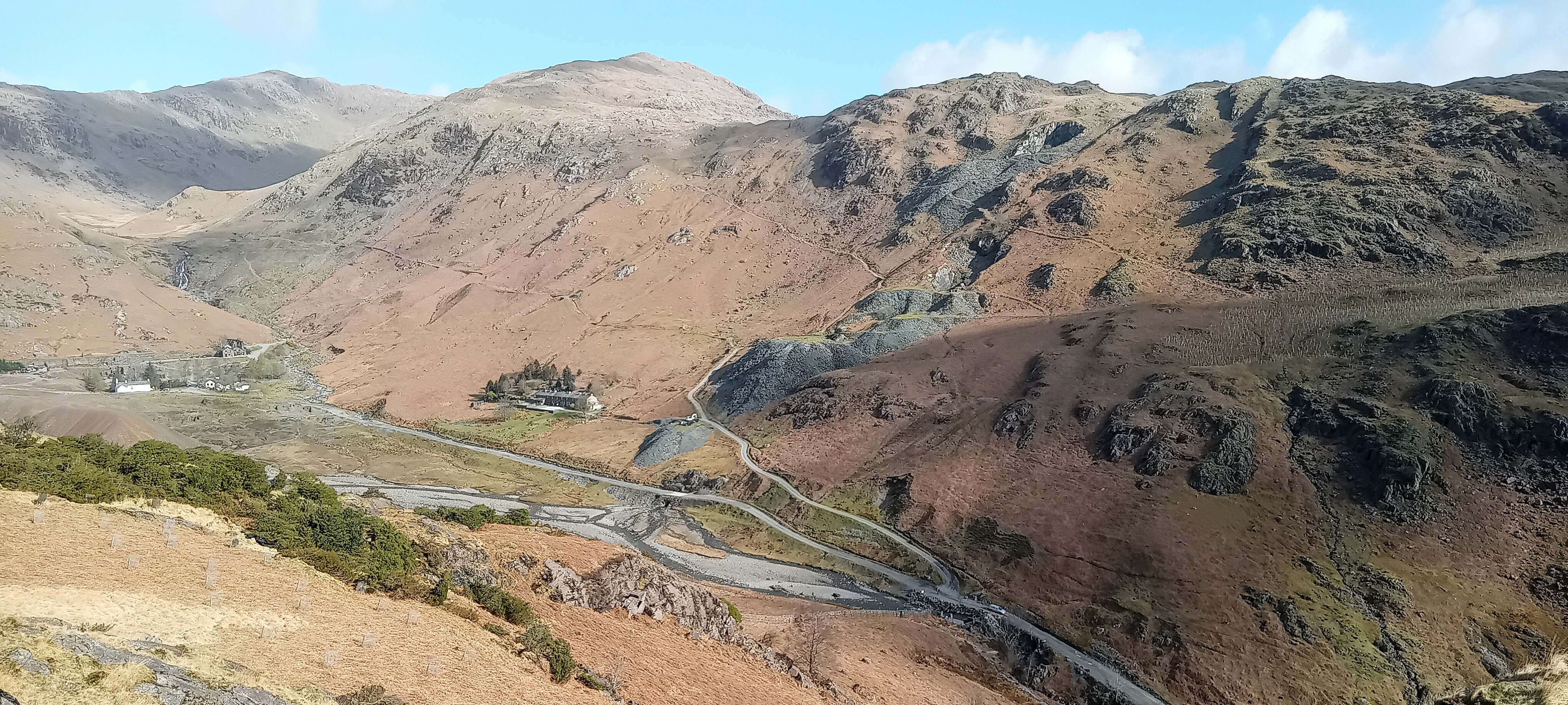
This area has a long history of copper mining, with remnants of old tunnels and spoil heaps still visible in the landscape today. Many of the trails pass through some of the historic workings, giving you a sense of stepping back in time

The Coppermine Valley
Once a hub of copper mining, the Coppermine Valley is now a fascinating location showcasing the region's industrial heritage. Old mining tunnels, spoil heaps, and remnants of historic mining operations can still be seen along the trails, providing insight into the importance of this area in centuries past. The valley is also surrounded by dramatic rocky slopes, making it a spectacular place to explore.
Boulder Valley
Boulder Valley, located to the east of low water, was shaped by glaciers during the Ice Age. The valley is littered with boulders (called erratics) that were transported and deposited by the ice, including a particularly large boulder, known as the Pudding Stone. Boulder Valley offers an interesting route to Levers Water, and passes several small spoil heaps, made up of waste rock left behind from the historic mining. Some of the rocks contain copper, lead and pyrite (fools gold).
Glacial Lakes and Streams
The Coniston Fells are home to several beautiful glacial lakes and picturesque streams, adding to the scenic charm. Levers Water, a stunning tarn nestled between the peaks, has crystal-clear reflections and is often visited for its tranquil atmosphere. Low Water, sitting just beneath The Old Man of Coniston, serves as a perfect resting spot for hikers making their ascent. Throughout the valleys, small streams cascade down rocky slopes, offering serene stops along the way.

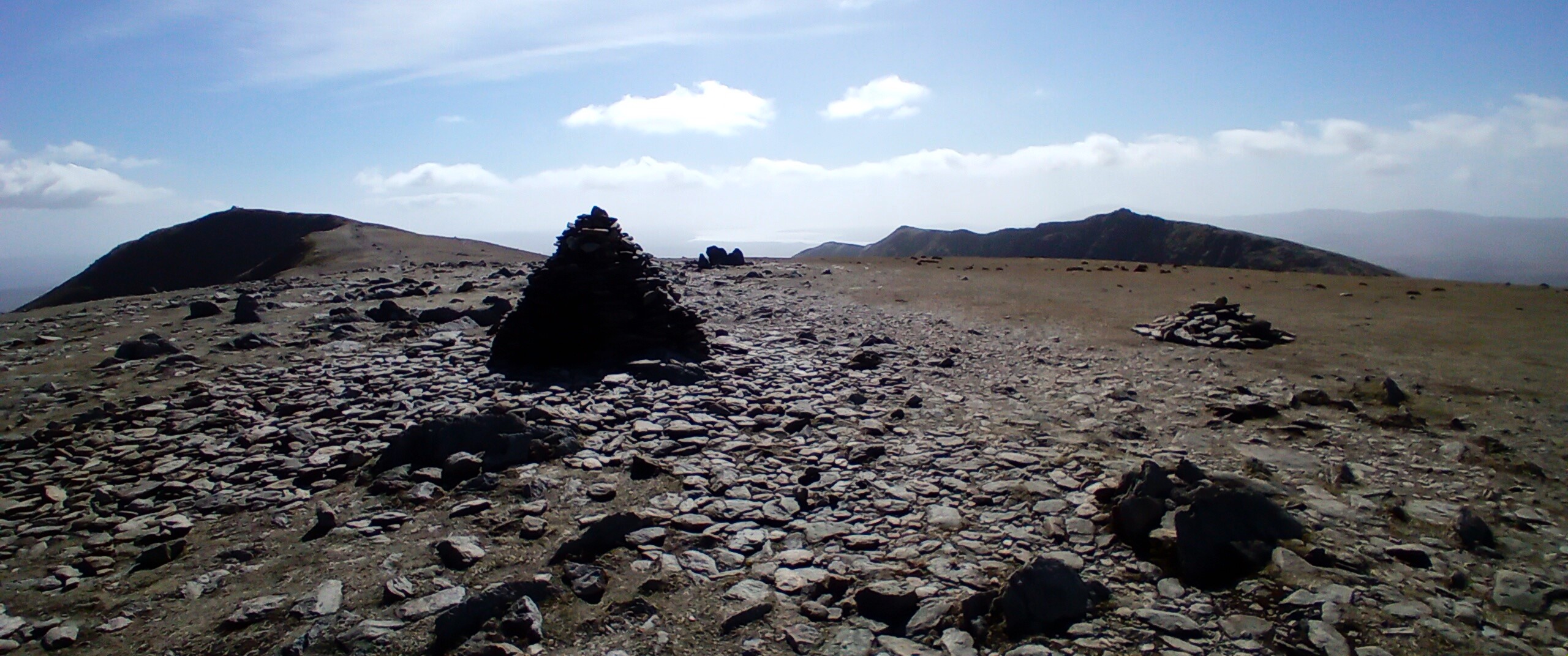
The Old Man of Coniston (803 m)
The most famous peak in the Coniston range, The Old Man of Coniston offers stunning views across Coniston Water and beyond to Morecambe Bay. The main ascent from the southeast follows a well-marked trail past Low Water and the historic mining sites. From the summit, hikers can continue toward Brim Fell and Swirl How for a ridge walk.

Brim Fell (796 m)
Brim Fell is situated between The Old Man of Coniston and Swirl How. The low relief terrain provides fairly gentle walking with views of Dow Crag and beyond.
Swirl How (802 m)
Swirl How is a rocky summit that stands to the north of Brim Fell, offering panoramic views of the Lake District. It sits at the junction where paths connect from Wetherlam, Great Carrs, and Brim Fell, making it an ideal point in a larger route linking multiple summits. The ascent from the east provides a rocky route with some short sections of light scrambling.
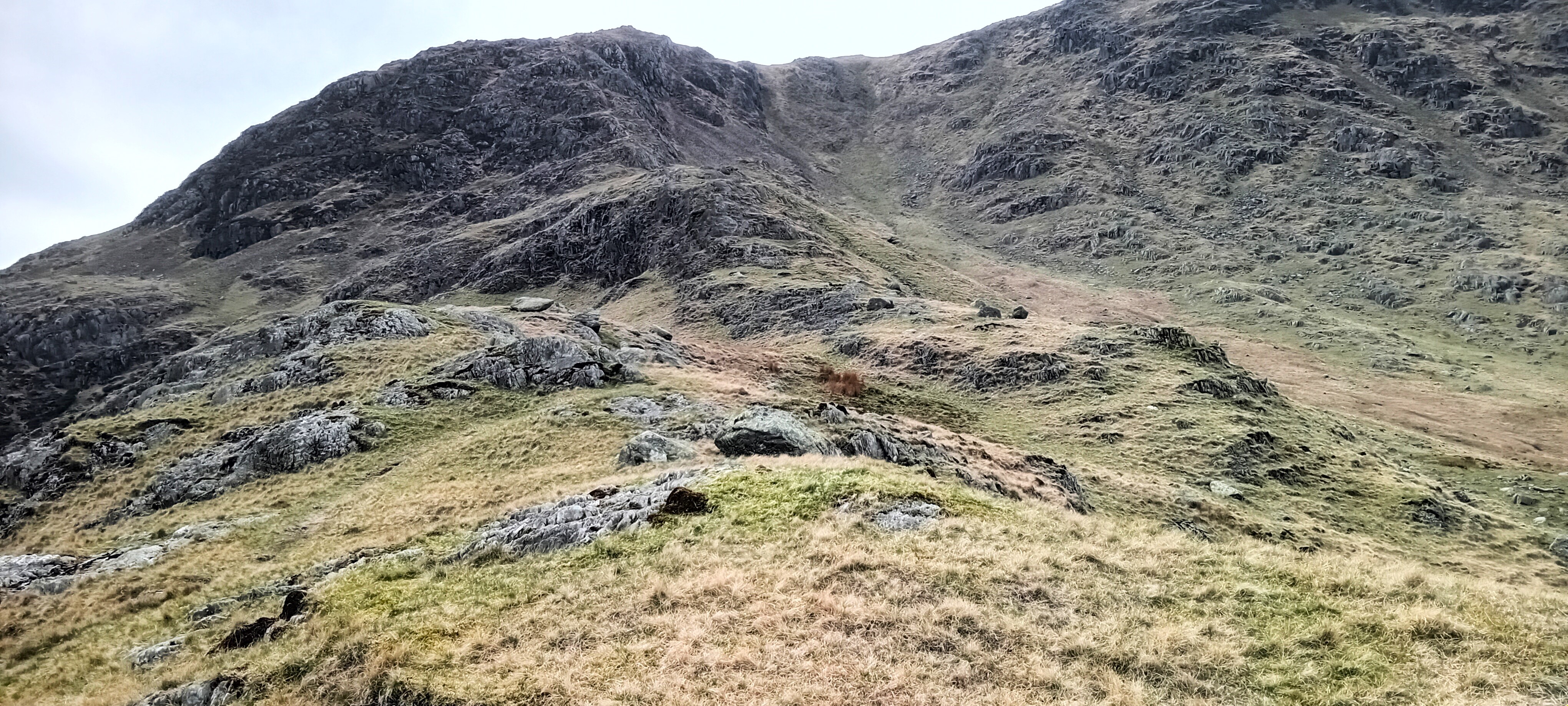
Dow Crag (778 m)
Dow Crag is a rugged summit west of The Old Man of Coniston, known for its steep cliffs and rocky terrain. The path from Goat’s Water leads to the summit, offering a scenic ascent. It connects directly to Brim Fell, making it a great part of a longer ridge walk across the Coniston Fells.
Wetherlam (763 m)
Wetherlam is another fell, slightly separated from the other summits. It can be reached by paths from Swirl How, Levers Water, and the Coppermine Valley. For hikers with good navigation skills and scrambling experience, Steel Edge offers an exciting ridgeline ascent from the east, providing incredible views of the valleys. Wetherlam contains remnants of old copper mines and can provide a less crowded hiking experience, making it a great alternative for a quieter adventure.
To book your hike, please message us via the contact form. Prices and availability will be provided upon request.