The geology of Twmpa and Hay Bluff (Black Mountains)
29 October 2023
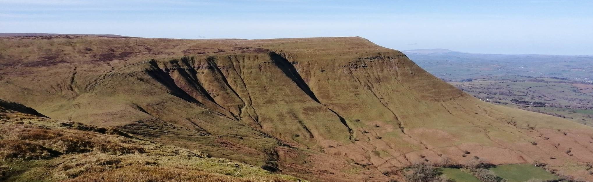
Across the Black Mountains of southern Wales, much of the geology is buried beneath vegetation and soil. In the far-north of the Black Mountains, close to Hay Bluff and Lord Herefords Knob (Twmpa), there are several places where the geology has been locally exposed by erosion.
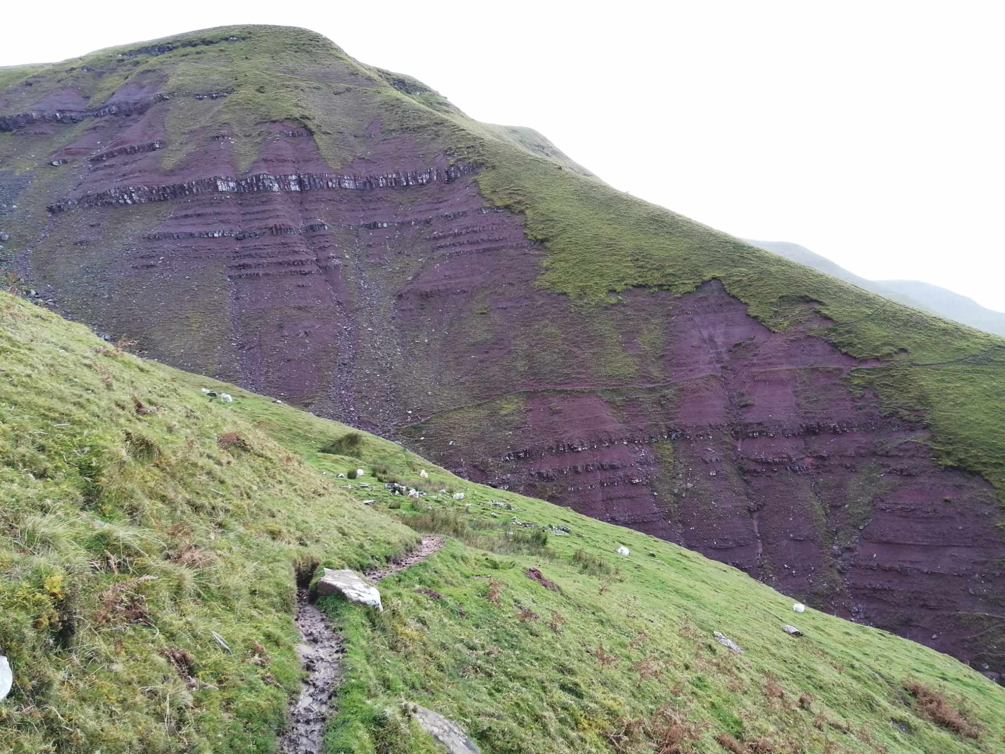
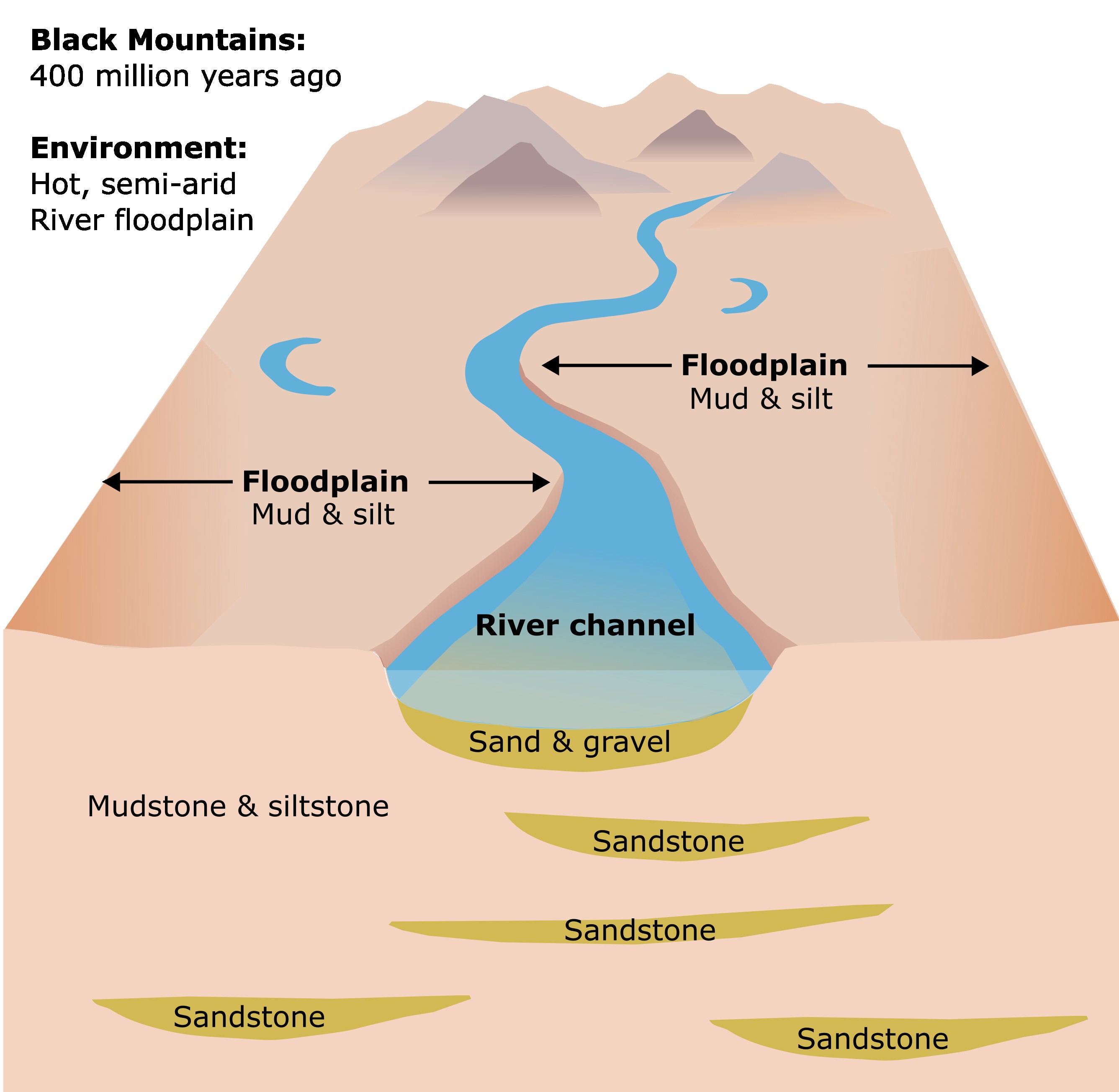
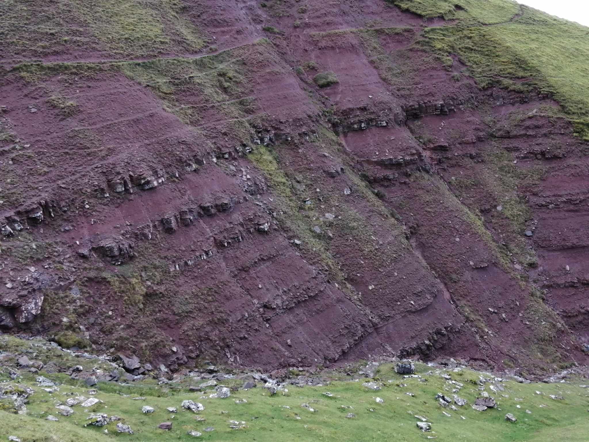
Perhaps the most impressive location is in one of the deeper gullies to the northwest of Twmpa where a thick sequence of sedimentary are exposed in a 150m thick cliff section. These rocks, which are part of the Freshwater West Formation, are 394 and 419 million years old and are comprised of mostly mudrocks and sandstones.
Mudrocks (mudstone and siltstone)
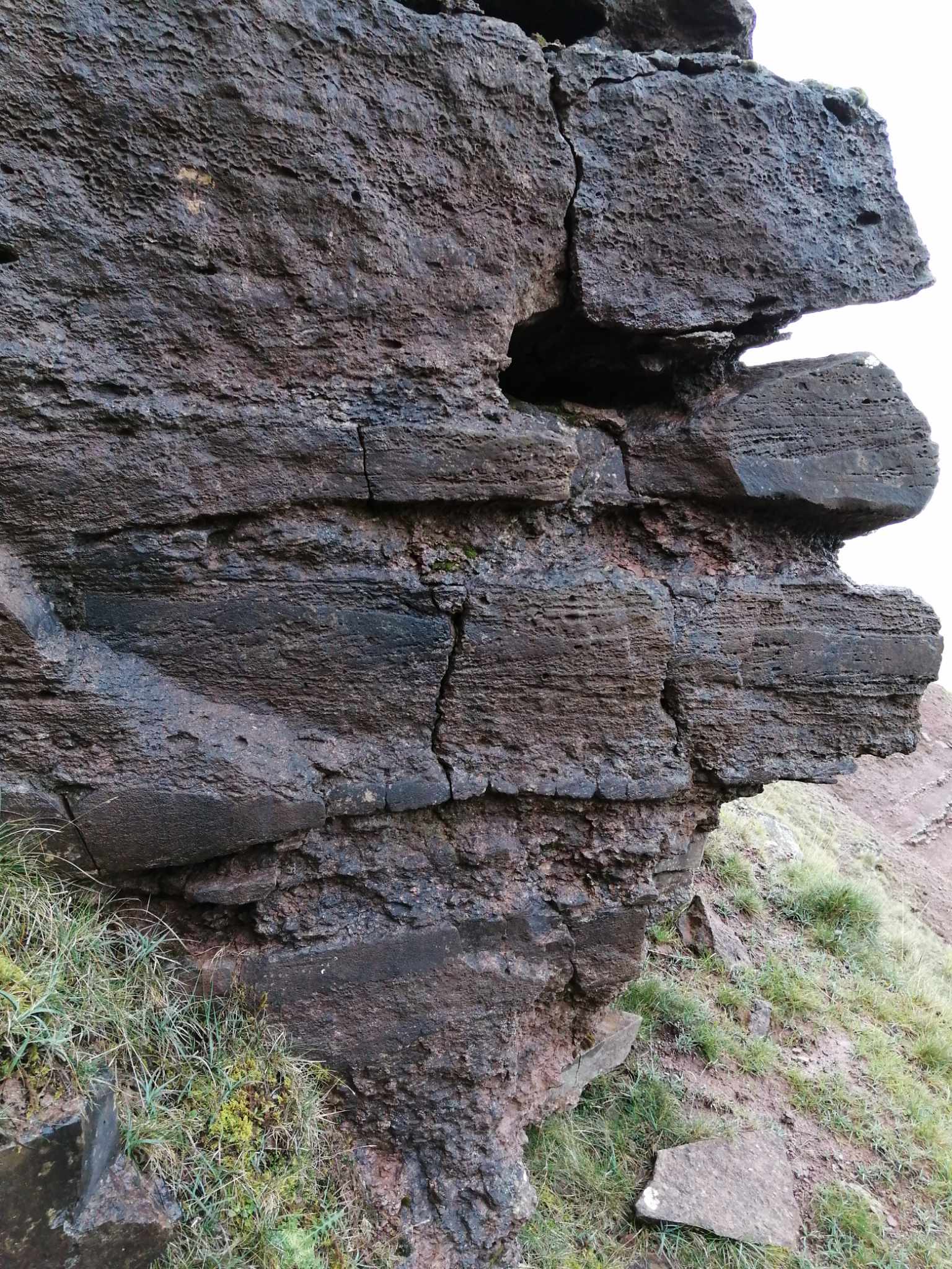
The mudrocks, which comprise mudstones and siltstones, are very fine grained and make up a large proportion of the rock layers in this area. They are distinctively red or reddy purple in colour, which suggests that 394 to 419 million years ago, the environment was hot and probably semi-arid.
The mudrocks are susceptible to erosion by rainwater, and many of the streams are reddish brown due to the mud that has been washed down from the mudstone beds. Physically, the mudrocks are also relatively weak and there are many places along the hillsides where the slope is slowly collapsing under gravity, resulting in landslips
Sandstone
The sandstones can be seen as prominent layers that appear white or grey from a distance. Up close, the sandstones can be light grey, dark grey, brown or slightly green. Various types of layering can be identified within the sandstones, including:
- Massively bedded: No layering is present.
- Parallel bedded: Individual layers are parallel to each other and stacked.
- Cross bedded: Layers are inclined and convex.
Of these layering styles, cross-bedding is particularly useful because it indicates the sediment was deposited under in a flow or current. In this area, the sandstones are interpreted to have been deposited in ancient river channels, so the cross-bedding indicates the direction the river that deposited the sands was flowing.
Unlike the mudrock layers that are very easily by rainwater over time, the sandstones are physically much stronger, which means they are more resistant to erosion. Consequently, the sandstones form prominent layers that form stepped layers in the cliff. The sandstone layers will collapse when enough of the underlying mudrock layer has been eroded. There are many blocks of sandstone scattered on the slopes where this has happened.
Conglomerates
Sometimes found above or below the sandstone layers are layers of conglomerate, which represents a coarse sediment deposit. Like many of the sandstone layers, the conglomerate layers represent sediment that was deposited within ancient river channels. The presence of conglomerates indicate periods of time when the rivers had significantly higher energy and faster flowing water.
Reconstruction
Geological studies suggest that 394 to 419 million years ago, the area where the Black Mountains lie was a vast floodplain, with a hot climate and semi-arid conditions. Numerous rivers and streams carrying sand crossed the landscape, while the riverbanks and floodplains accumulated thick mud and silt.